Shaowu, Futun Creek, Qiao Creek, Zhaowu, East Gate (Chaoyang), West Gate (Yanbin), South Gate (Gongyang), North Gate (Tongyuan), Qingfeng Gate (Water Gate)
Did you know that Shaowu once had a 4,400-meter stone city wall?
Five gates, 48 enemy towers, over 1,200 crenellations. The base was 1.5 zhang wide, the top 1 zhang, all built from cut stone blocks.
They called it “Iron Shaowu.”
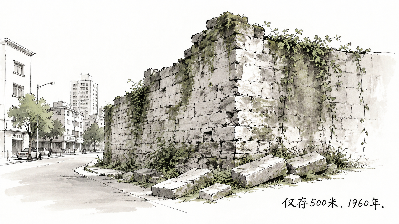
Today, almost nothing remains. Less than 500 meters of broken walls scattered near the East and South gates.
But the story of this “Iron City” deserves to be remembered.
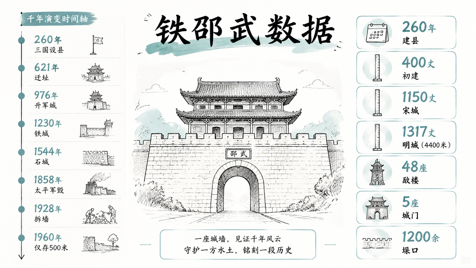
260 AD: The Birth of a County
Shaowu’s urban history begins in the Three Kingdoms period.
In 260 AD, the Eastern Wu regime established “Zhaowu County” in the mountains of northern Fujian. The original seat was in what is now Guxian Village—a modest earth wall town with a perimeter of only about 400 zhang (roughly 1.3 kilometers).
The real turning point came in 621 AD, the 4th year of Tang Wude.
That year, the county seat moved to its present location: the north bank where the Futun Creek meets Qiao Creek.
Why the move? Because the Futun Creek’s navigational value was growing. Cities follow waterways—a rule that never changes.
This relocation laid Shaowu’s urban foundation for the next 1,400 years.
The Birth of “Iron Shaowu”
In 976 AD, the 1st year of Northern Song Taiping Xingguo, Shaowu was elevated to a “Jun” (Military Prefecture)—equivalent to a prefecture-level city.
With higher status came expansion.
The walls began using rammed earth encased in brick and stone. The circumference grew to 600 zhang. A moat was dug, fed by Qiao Creek.
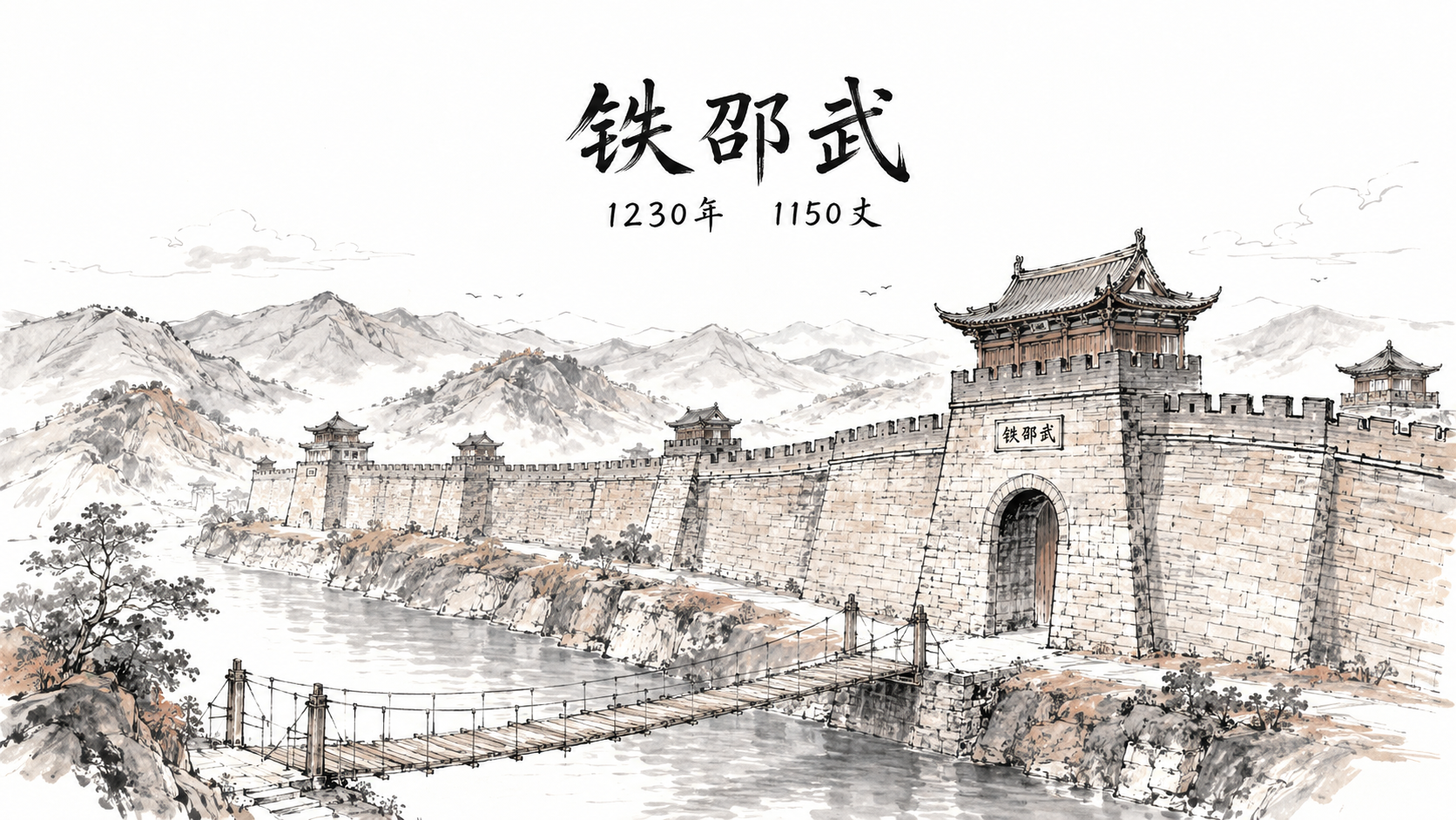
But the true “Iron City” was forged in 1230.
In the 3rd year of Southern Song Shaoding, Prefect Li Zhi undertook a historic expansion. The circumference was extended to 1,150 zhang (about 3,800 meters), and the height reached 2 zhang 4 chi.
The walls featured 48 enemy towers and over 1,200 crenellations.
This density of defense was unparalleled in northern Fujian. When the Mongol army later swept south, Shaowu held firm. The name “Iron Shaowu” was earned through blood and stone.
The Stone Era
In 1368, the Ming Dynasty was established. Shaowu’s city walls received a complete upgrade.
In 1544 (the 23rd year of Jiajing), the prefect mobilized massive civilian labor to replace all earthen sections with cut stone.
The base was 1.5 zhang wide, the top 1 zhang. The total circumference grew to 1,317 zhang—approximately 4,400 meters.
The five gates each had a role:
- East Gate (Chaoyang): Connecting to Jianyang and Jian’ou
- South Gate (Gongyang): Facing Qiao Creek, the commercial center
- West Gate (Yanbin): Leading to Guangze and Jiangxi
- North Gate (Tongyuan): Backed by the Futun Creek
- Qingfeng Gate (Water Gate): A dedicated shipping channel
In 1755 (the 20th year of Qianlong), the moat was dredged and found to be 7 zhang wide and 1.2 zhang deep.
Defense. Drainage. Commerce. This was the complete “Iron Shaowu.”
The Disappearance
No wall, no matter how strong, can withstand the march of time.
In 1858, the Taiping Army attacked Shaowu. The walls endured artillery bombardment. The Qing government spent 15,000 silver taels on repairs and added 12 cannon platforms.
But patching wounds wouldn’t save the patient.
In 1928, to build roads, Shaowu began demolishing sections near the West Gate.
In 1934, the Shaowu-Guangze Highway opened. The wall’s mission as a closed defense system was officially over.
In 1951, Shaowu began systematic demolition. During the 1958 “Great Leap Forward,” most bricks were hauled away to build factories and irrigation systems.
By 1960, less than 500 meters of the original 4,400-meter stone wall remained.
An “Iron City” had vanished.
The Numbers
A timeline tells the story of this “Iron City” across a millennium:
- 260 AD: Zhaowu County established, earth walls built
- 621 AD: Relocated to present site, ~400 zhang
- 976 AD: Upgraded to Military Prefecture, 600 zhang
- 1230 AD: Expanded to 1,150 zhang, 48 towers, named “Iron Shaowu”
- 1544 AD: Fully upgraded to cut stone, 1,317 zhang (4,400 m)
- 1858 AD: Damaged by Taiping Army
- 1928 AD: Demolition begins for roads
- 1951-1958: Mass demolition
- 1960: Less than 500 m remain
From 4,400 meters to 500. From whole to broken. It took only decades.
But the gate names survived. “Chaoyang,” “Gongyang”—these ancient place names remain on Shaowu’s city map.
Buildings disappear. Place names don’t.
In 2014, Shaowu launched the “Ancient City Cultural Restoration Project,” reinforcing surviving sections of the South Gate wharf and wall foundations.
This “Iron City” is returning to people’s consciousness—in a different way.
The walls fell. But the memory remains.